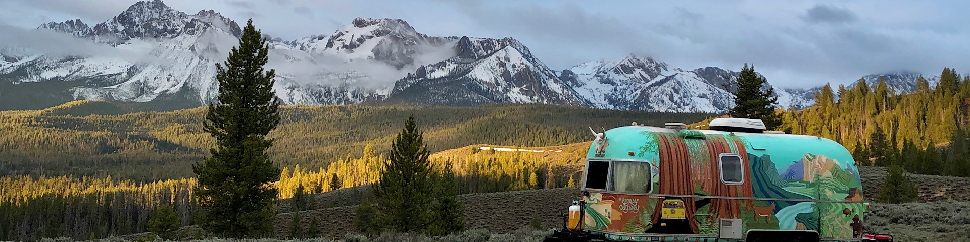


After traveling over 60,000 miles around the states the past few years, if anyone asked us what our favorite stretch of road was in the country, we’d have to say Hwy-395!
Running along the Eastern Sierras, CA Highway-395 is the perfect place to escape the crowds while enjoying some of the most spectacular views California has to offer. With it’s otherworldly landscapes, Old West history, and unique volcanic geology, this route provides jaw-dropping scenery, as it winds down California’s backbone. Nearly 557 miles in its entirety, along this trek you’ll pass dozens of hot springs, ghost towns, alpine lakes, and rock formations that’ll make you wonder if you’ve transported to another planet. During the Eastern Sierras fall season, the quaking aspens turn gold and their granite peaks are dusted with snow, creating the perfect backdrop for an autumn roadtrip. Best of all—- you will find plenty of free camping opportunities on this side of the state!
Bridgeport and Travertine Hot Springs


Heading South on Hwy 395 from Reno, you’ll pass Topaz Lake at the California border and head towards Bridgeport, a charming Victorian town of about 560 residents, and the first destination. Just a couple minutes outside of town, you’ll find Travertine Hot Springs, one of our all-time favorite soaks and the perfect place to warm up on chilly autumn days. After setting up camp in the dispersed area leading to the hot springs, we enjoyed soaking in the 4 natural pools of varying degrees. To have the place to yourself, get up at sunrise and enjoy the springs while the alpenglow paints the mountainsides. If you decide to stick around another day, Buckeye Hot Springs is another one nearby that will not disappoint. As always, don’t be “that guy”—- leave the hot springs and nearby camping area better than you found it!
Bodie Ghost Town


Continuing the trek South towards Mono Lake, take the cut-off to the historic town of Bodie. Maybe the best preserved ghost town of the ‘Old West’, Bodie State Historic Park, between Bridgeport and Lee Vining remains in arrested decay, offering visitors the most authentic ghost town experience you can get. The small mining camp became a boomtown after a profitable deposit of gold was found in 1876, bolstering the population to 10,000 people, and at one point, was one of the largest cities in California. Its next claim to fame was creating the world’s first long distance electrical transmission network, which changed the mining industry on a global level. After several fires, it was abandoned by 1950 and became a National Landmark in 1961. This park is pet-friendly and many building are open to visitors, otherwise, you can peek through the windows to see the untouched and dust covered interiors.
Mono Lake and Panum Crater


At the intersection of Yosemite’s Tioga Pass and Hwy 395, is Mono Lake and the town of Lee Vining. Mono is a large shallow alkaline lake, best known for it’s Tufa formations; bizarre limestone towers created underwater by springs rich in calcium and can grow to heights of 30ft. In the middle of the lake is the volcanic island, Paoha, which was formed only a few hundred years ago. Take a hike next door along Panum Crater’s rim trail and catch gorgeous views of Mono Lake as well as explore the volcano’s plug full of obsidian. Mono County also has several breathtaking spots to view fall color, including Lundy Canyon, Walker Lake, Conway Summit, Virginia Lakes, and Sonora Pass. For a longer excursion, wake up early and take a drive along Tioga Pass to Yosemite, whose national park borders begin 13 miles West of Lee Vining. While visiting, we camped at Mono Lake’s dispersed area, a sagebrush plateau with 360 degree views of the Sierras and the lake below. Part of the Mono Lake SNR is closed currently due to fire recovery, but you can still see the tufa formations at the Old Marina boardwalk and County Park boardwalk. Remember to respect the area’s fragile geology and follow the guidelines posted nearby.
June Lake Loop

One of Hwy-395’s best excursions is the June Lake Loop (route 158), a 16 mile drive that whisks you away to higher elevations and several lakes, including June, Grant, Silver and Gull Lakes. To explore some of the smaller lakes and get a birdseye view of the area, take the 3.8 mile round-trip hike to Parker Lake or the 10 mile trek to Yost Lake. While exploring June Lake, make sure to drop by the pet-friendly June Lake Brewery!
Hot Creek Geological Site and the Long Valley Hot Springs


Hot Creek Geological Site, also known as “Little Yellowstone”, sits within the Long Valley Caldera and contains colorful geothermal springs similar to Wyomings. Temperatures are unpredictable and can change rapidly, soaring as high as 450F degrees, so people are no longer allowed to swim in the pools, but the short trail that winds its way along the creek offers great views of the Sierras and vibrant pools of the hot springs. Just down the road you’ll find several “people-friendly” hot springs, like Wild Willy’s, Rock Tub, Shepard, and Crab Cooker, many of which you can camp at.
Devils Post Pile National Monument

Located just down the road from Mammoth Ski Village, Devils Postpile National Monument preserves one of the world’s best examples of columnar basalt. This towering geological feature is 60 feet high and due to radiometric dating, it’s believed to have been created by a lava flow within the past 100,000 years. At one time, Devils Postpile was within Yosemite National Park’s borders, but the discovery of gold in Mammoth Lakes led to a boundary change that left the site on adjacent public land. Later, conservationists were instrumental in persuading the federal government to protect the area and the monument was officially established in 1911. While exploring Devils Postpile, continue up the trail a little more until you reach the 101ft high Rainbow Falls. To enjoy some fall color, take the drive to Convict Lake.
Ancient Bristlecone Pine Forest

Situated high up in the White Mountains of Inyo County, you’ll find one of the world’s oldest living non-clonal organisms and the planet’s oldest single tree. Dated over 5,000 years old, this unnamed ancient tree (not to be mistaken for Methuselah, the previous oldest tree) is nearly 3,000 years older than Sequoia National Park’s Sherman Tree and was about 500 years old when the pyramids in Giza were built! These gnarled, weather-beaten Great Basin Bristlecone Pines thrive in their xeric-alpine environment, a home very few plants can survive. The forest is located in a high altitude rain shadow and endures both sub-zero and scorching temperatures depending on the season, along with heavy winds. While there, take the 12 mile drive from the visitor center to Patriarch Grove, home of the world’s largest bristlecone pine, the Patriarch Tree.
Manzanar National Historic Site


Just north of the Alabama Hills and right off hwy 395, is the sobering site of one the country’s darkest periods in history. Manzanar was one of 10 concentration camps in the United States erected during WW2 that housed Japanese immigrants and Japanese-Americans after the attack on Pearl Harbor. On February 19th, 1942, another date that will live in infamy, President Roosevelt signed the executive order that authorized the arrest of 125,000 men, woman, and children. They were bused in and were not allowed to bring very many belongings, so many of them were forced to sell their homes, cars, and heirlooms at a significant loss. When they arrived, they were packed into barracks, where they had little to no privacy, while sharing undivided toilets, showers, and sleeping quarters. At it’s peak, 10,046 people were imprisoned at the Manzanar camp just south of Independence, California, where they continued to live until the camp was discontinued in 1945. While there, the internees attempted to make the best out of an unconscionable situation and created churches, clubs, newspapers, gardens, and orchards. Today, you can visit the site and take an auto tour of the barracks, cemetery, and gardens. Once Covid restrictions are lifted, you can tour the visitor center and Block 14.
Alabama Hills and Mount Whitney


Located a couple miles outside of Lone Pine, the BLM designated Alabama Hills is a range of rounded rock formations starkly contrasting the ragged peaks of its Sierra backdrop. Sitting at the base of Mt. Whitney, the tallest mountain in the Lower 48, the Alabama Hills provide the perfect playground for rock climbers, hikers, bicyclists, and photographers- it’s also one of our all-time favorite places to boondock as there are endless opportunities to find nooks and alcoves in the rocks to set up camp. The Alabama Hills has also been a favorite film location for Hollywood, with over 300 credits including Tremors, the Lone Ranger, and Star Trek, as well as dozens of old Westerns. For scenic drives, drive to Whitney Portal, the gateway to Mount Whitney, which takes you up to 8,374 feet in elevation. The Movie Road drive is another fun one as you’ll pass filming locations of many movies as well as absolutely bizarre rock formations. While there, make sure to hike the short loop trail to Mobius Arch, and when Covid Restrictions lift, check out Lone Pine’s Museum of Western Film History.
Death Valley National Park


The terrain that follows hwy 395 is a land of superlatives, where you’ll find the highest peaks, the lowest elevations, the oldest trees, the driest deserts, and the hottest temperatures—and there’s no better example of that than Death Valley National Park. Established in 1994, Death Valley is the largest national park in the lower 48 and has nearly 1,000 miles of roads that provide access to both popular and extremely remote locations. Death Valley’s Badwater Basin is home to the lowest point in North America at 282 feet below sea level. It’s also the hottest place on Earth, breaking the global record at a scorching 134F degrees. This land of extremes has a unique kind of beauty you would be hard pressed to find elsewhere, and some of our favorite spots include the colorful Artist Palette, Zabriskie Point, Devils Golf Course, Dante’s View, Mesquite Sand Dunes, Mosaic Canyon, and Telescope Peak. While there also make sure to check out Saline Valley Warm Springs and Rhyolite Ghost Town.
Trona Pinnacles


If you need to escape California for a bit, teleport to another planet and camp out at Trona Pinnacles. This otherworldly landscape consists of more than 500 tufa spires and can be found close to the town of Ridgecrest and down the road from China Lake, a secretive Naval weapons research station.The tufa towers at Trona Pinnacles are remnants from Searles Lake and formed under water from 10,000 to 100,000 years ago, similar to the tufa formations at Mono Lake. In 2016, the Bureau of Land Management designated Trona Pinnacles part of California’s Desert National Conservation Land and the area is now permanently protected from development. Though the road in is full of washboards, any vehicle can make the trek during dry weather. Camping in designated areas is free and you can stay up to 14 days, just know that the only amenity is a single vault toilet. While there, meander around the tufa formations on pet friendly foot trails, and enjoy stargazing at night. Speaking of galaxies far, far away, Trona Pinnacles has been a choice location for Hollywood Sci-Fi’s and has served as the backdrop of films including Star Trek/Final Frontier, Planet of the Apes, Battlestar Galactica, Lost in Space, and Disney’s Dinosaur.

The Eastern Sierras are chock full of free camping spots: This is how we find them……

Did you know that there are 245 million acres of BLM (Bureau of Land Management) along with 154 National Forests that offer free dispersed camping around the country? In general, camping is legal anywhere that isn’t posted otherwise— as long as you stay 100ft off the road, trail, or water source. Though we occasionally boondock on other agency land, 99% of the time our spots are on BLM and NF land.
So how can you tell if you are on BLM or National Forest land?


One of our favorite camping apps is the Dyrt Pro App, which offers campers an off-line database with thousands of reviewed camping spots. In fact, the Dyrt has the largest US campsite database on the Internet! One of the best features of the app is their recently released “Map Layers” which shows the boundary lines of National Forest and BLM land— so you know exactly whether the land you’re on is fair game. Like most of the places we’re exploring, cell service is nonexistent, so it’s helpful to be able to access these maps and campsites without needing reception.
Some other neat features included with The Dyrt Pro App….
- The “Trip Planner” feature helps plan your road trip. Just plug in your start and end point along with any filters you’d like to add, and let it do the work for you! It will also help you estimate fuel costs and plan gas stops!
- The “Pro Discounts” feature allows you to save up to 40% off on outdoor gear and select campgrounds.
To receive 10% off Dyrt Pro memberships at checkout,
use the code: Argosy
Click Here To Sign Up

And as always… Leave it better than you found it. Pack it in, pack it out, and help keep our Public Lands beautiful and untouched for future generations. -Cate, Chad, and Frankie Battles
*Much of the West has endured hardships between wildfires and pandemics in 2020, so we suggest you plan now, and enjoy it next year. Check location websites for updates as things can change quickly.*
What a great post Cate & Chad! And your photos are enticing! I am just now planning a trip in that direction and was deciding how I would move north through California to Oregon to see a friend in Portland. Bingo! There we go!
Thanks!
Hi ! Just found your blog a few days ago . I believe thru driving and viben. I live in Truckee ,Ca. and often go down 395 for a couple weeks to camp. Love the whole area. If you are still around. Check out Rock creek area too. Turn off is at Tom’s place.
May I ask what camera you use ? Or what editing programs? Your colors are so vibrant. Love the goat! and the bus !!
This is a FANTASTIC summary / trip itinerary! Thank you for continuing to produce such great content.
Thank you so much for the feedback. Happy Trails Andrea!
Thank you both and of course Frankie. Love 395 my favorite Hwy in all of California and maybe the entire West. Dont get over there much wish I could do it more. Take care and Happy Trippin
thanks so much!
this seems so cozy, I enjoyed alot your log
My sister says I should come check out your blog, so I am. Impressed so far. Looking forward to reading future posts!